 |
| Fitz Roy from Laguna de Los Tres. Our route ascends the glacier on the far side. |
Thursday:
Today was the last good weather day of the trip. We would leave El Chaltén at 7 a.m. Saturday morning and Friday looked bad. If we were going to go for it, it would have to be today. Fitz Roy had not been climbed in under a day, roundtrip, from town before, though Colin Haley and Andy Wyatt only took 21h08m via the Supercanaleta from the bridge over the Rio Eléctrico. So here was our chance to get in the record book. Even if we failed, it would be an audacious attempt.
We started at 5:30 a.m. Already it doesn’t sound serious, but it gets better (worse?). We didn’t bring a rope. Or harnesses. Or rock shoes. Or any gear. So bold! Right? Actually, just the opposite. We are so intimidated by this peak that it was just a recon trip up to Paso Superior, where we’d bivy on a real attempt. We are also so inspired that we plan to return here, now that we know a little bit about the place and can train for another year.
We hiked into Laguna de Los Tres - probably the most popular destination in the entire park, and rightfully so. The view of the massif is beyond ridiculous. Since we went pretty early, we didn’t face the massive conga line that Sheri was forced to stand in. Still there were people to pass, but it wasn’t a problem.
 |
| Descending the first fixed line around Los Tres |
True, we didn’t even try this mountain, for all of the above reasons. We weren’t mentally ready to tackle such a mountain, nor did we get a weather window that was wide enough for us to attempt it with a reasonable degree of safety. But we’re putting in the necessary work to get our minds ready for a future attempt.
 |
| Fixed lines leading to Paso Inferior |
At this higher lake, we found Javier and Juan. Two badasses from northern Spain. Javier Seinem, Juan told us, was the most prolific first ascensionist in Spain. It was his 55th birthday today. He’d previously climbed Cerro Torre via the Compressor Route, Fitz Roy via the Franco-Argentine, and Aguja Standhardt via Tomahawk (Conrad Anker’s route) to Exocet. Juan was his protege — “él es el futuro” as Javi put it. They were planning to do the Casorotta Route on the Goretta Pillar of Fitz Roy. They had already been up to Paso Superior once before with all their gear and had dug a snow cave up there. They were now headed up with food and clothes and hoped to give the route “a look” on Saturday, as the weather Friday was supposed to be bad. So, we stumbled upon a team to guide us up to Paso Superior. Nice.
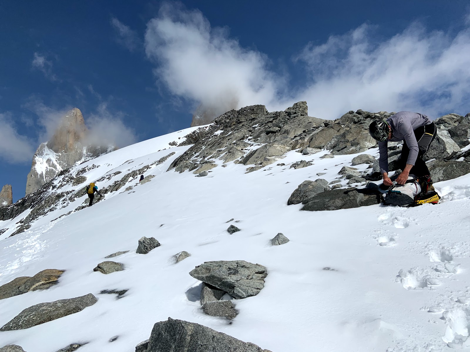 |
| Switching back into crampons at the top of the rock step above Paso Inferior |
The angle wasn’t too steep to begin with and we climbed up either hard snow or ice covered with an inch or two of snow up to the first steep section, where the snow was deeper and Juan was in front, probing for the bergschrund. He located it without falling into it and then carefully stepped over it. There was solid ice on the other side and he got solid sticks with his axe. Above we front-pointed for fifty feet before the angle eased and the snow returned.
 |
| At Paso Superior. Juan and Javi are trying to find the snow cave they previously dug. |
Paso Superior is a serious place. It’s a tiny little bowl in a notch on the ridge, with hanging glaciers on both side of the ridge and an imposing rock wall directly to the west. The route up Fitz Roy descends, via a fixed line, fifty feet down to the north to gain the Glacier Piedras Blancas Superior. This is followed (frequently an energy sapping slog that sometimes requires floatation) up to the rock pyramid of Fitz Roy. Just as we got here, the clouds rolled in and we could no longer see most of this pyramid. The wind came up and it suddenly became cold, after being borderline hot on most of the way up. We declined to go further. Instead we had a little something to eat and drink and then bid farewell and good luck to Juan and Javi.
 |
| Fixed lines and descent down to the Glacier Piedras Blancas Superior from Paso Superior |
When we changed out of our boots and back into our trail runners, we both put on shorts. It wasn’t the warmth that drove me to the shorts, but my pants were a bit wet from all the snow travel. Now, in the early afternoon, the crowd at the lake was prodigious. It was by far the most people I’ve seen congregated anywhere on this trip. I don’t blame anyone for wanting to come to this lake, but the crowds certainly diminish the appeal and we moved on without much delay. Besides, when we arrived in the morning, there was not a cloud in the sky. Now, Fitz Roy was back under its near-constant blanket of swirling mist. The crowds descending the very steep, rocky, loose trail below the lake were thick, but we managed to pass frequently, whenever a good option allowed. We were mostly able to move at our own pace via some aggressive rock hopping
 |
| Derek ascending the final fixed line used to traverse around Laguna de Los Tres |
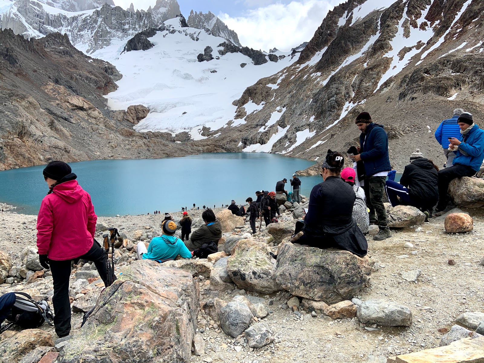 |
| Massive crowds at the lake on our way out. |
The totals for this trip were just under 20 miles and 6500 vertical feet. Getting a full load of gear to Paso Superior would be a full-day of serious work. I couldn’t have done the fixed lines with the loads we carried to Piedra Negra. Probably taking multiple trips, like Juan and Javi, is the right approach. There were good bivy spots at the small lake above Los Tres where you could stage more supplies. We both felt just knowing this approach helped increase our confidence for a future Fitz Roy attempt. We think this is a necessary learning process for us. Others might just go at the peak, as I had originally hoped. But looking at this route in the guidebook and in person are two different things. Fitz Roy is no joke. It’s the real deal.
1 comment:
For climbing, hiking this is the best place. If you love adventures then book now Patagonia adventure tours
Post a Comment