 |
| Traversing the complex ridge to Paiute |
The Continental Divide, in Colorado, houses incredible peaks, exposed, technical ridges, and high altitude adventure. The most spectacular terrain lies in Rocky Mountain National Park and its adjacent southern neighbor the Indian Peaks Wilderness. Gerry Roach wrote how Karl Pfiffner envisioned a traverse on the Divide from Milner Pass, on Trail Ridge Road in RMNP, to Berthoud Pass, but never attempted it. Gerry eventually did a 2-week backpacking trip that started and ended in those locations, but avoided all the technical climbing on the Divide itself and strayed significantly from it. He named it the Pfiffner Traverse.
 |
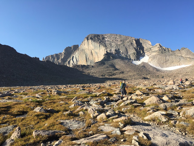
| Heading up Longs Peak at the start of the LA Freeway |
In July 2011 Mark Oveson modified the route slightly, calling it the "Pfast Pfiffner" and did the entire traverse in
one monster 37h44m push. I think Mark might still be the only person to do this in a single go. I know Andrew Skurka has developed a guide package for it and he might have done it as well. I was with Mark on his first attempt on this ono July 6, 2001 and we got halfway before incessant rain caused me more misery than I could take.
Still inexperienced at massive projects like this, John "Homie" Prater, Lou "The Loobster" Lorber, and I attempted the "Pfiffner Direct" over July 22-23, 2002. Over 1.5 days we made it from Milner Pass to Buchanan Pass where 12 hours with no water weakened us to point of abandoning. Along the way we stood atop every peak on the Divide. To my knowledge this is the only attempt at the Pfiffner Direct, and it highlights the biggest problem of this traverse: water. Or more specifically, the lack thereof. Being directly on the Divide leaves you scant chance of finding much water. The terrain is technical enough where you want most snow-free conditions, but then you have the water issues.
 |
| Descending off Pagoda |
The other major problems with the traverse are the length and the technical difficult. The technical difficulty is concentrated in the middle with the northern and southern portions being primarily high mountain tundra and ridge hiking. In 2002, Buzz Burrell did a 2-day traverse from Longs Peak to South Arapahoe Peak and called it the LA Freeway. All but the first two peaks, Longs and Pagoda, are on the Continental Divide, so this consists of the technical crux and center section of the Pfiffner Direct. Buzz dropped down off the Divide to sleep for his one night and to restock on water. Doing this traverse, which is roughly 35 miles and 22,000 feet of vertical gain, in just two days requires an extremely fit endurance athlete, considerable technical climbing skills, and extensive route knowledge.
 |
| Still smiling on top of Chiefshead |
The LA Freeway had not been repeated until 2017 when Peter Bakwin put in a very impressive effort over two days only to bail due to weather and route finding difficulties on the Kasparov Traverse from Shoshone to Apache, more than 85% done with the traverse. A couple of weeks later uberfit mountain runner Matthias Messner, after extensive reconnoitering, did the
entire LA Freeway in less than 17 hours! It is impossible to appreciate this achievement without intimate knowledge of the terrain.
Being friends with all the parties above, my interest was rekindled in this traverse and my son Derek, as gungho as only the naive can be, wanted to give it a try. Hence, we picked Labor Day Weekend, as we had the time and hoped for good weather. When the reports looked like stellar, clear, warm weather, we finally committed the night before. It felt strange to pack for something so audacious in just an hour.
 |
| Heading toward the Hourglass Ridge on Mt. Alice |
Our lack of planning and forethought hurt our chances, but it added to our adventure. I was over confident because I had previously covered almost all of the terrain. The only portion I hadn't before was from Arikaree to North Arapahoe, probably about a single mile of travel. But it had been a long time since I'd been on the tricky sections and my confidence in my memory was misplaced. My lack of respect for dehydration, despite my previous experience on this same terrain, seems irrational and ridiculous.
We each carried Ultimate Direction Fast Packs (thanks, Buzz), Derek a 20-liter and I a 30-liter. We each had a sleeping bag, pad, long pants, long sleeve shirt, hat, gloves, shell, headlamp, and food. We had sunscreen, a SPOT locator, our phones (primarily as cameras), and a tiny 2-man tent. But our biggest mistake was that Derek started with just 84 ounces of fluid and I with 70 ounces. This was just plain dumb. Which is embarrassing to admit for guy with the experience that I have. I know Anton does monstrous outings with little water and Kilian Jornet climbed Denali, round trip on a liter of water (which is the most amazing feat of adventuring with little water that I've ever heard of), but I know that I cannot do that. Yet, I still carried so little. Why? I didn't want the wait and stupidly hoped we'd find some water, despite knowing the chances of that were nil. I'd say "live and learn", except that I've proven that I don't learn. Live, screw-up, and repeat the same mistakes is more accurate in my case.
 |
| Derek climbing up the crux pitch on Isolation |
I remember Peter telling me that he had no desire to do any of this traverse in the dark. That sounded good to me, so Derek and I started hiking at 6:20 a.m. We took the lower shortcuts on Longs and then followed the Keyhole Route to the summit. Normally we'd have taken the North Face route, but heard it was seriously iced up. We made the summit in about 3h15m and, after a quick photo, descended and headed for Pagoda.
I didn't find the easiest descent but went directly to a 5.4 downclimb that I was familiar with. Derek followed me down and he was solid. We traversed over to the low point and then up tiring talus to the summit. I finished my first 20-ounce bottle on this summit. Twenty ounces in 4+ hours of difficult terrain. That isn't enough. We were trying to conserve and we needed to conserve, but we were heading for disaster, though we didn't know it yet.
 |
| Taking a break on the slopes of Isolation |
After another photo we headed down the West Ridge. This was going to be the trickiest route finding for me. I'd done some version of this before, three times, but always different, once the opposite direction, and never got it wired. Peter had told me to head down the first rib and we were down there looking off both sides and trying to decide what to do when along comes our friend Cordis. He had Peter's GPS track from his Wild Basin traverse and with that to guide us we eventually found the right way down. We lost at least 30 minutes here, I'd guess.
Cordis zipped off and we followed. Down the 3rd/4th class terrain to the horribly loose talus ledge that heads down and back to the east. Then down a steep but easy downclimb to the key ledge that cuts all the way back to the Pagoda/Chiefshead col. We toiled up endless talus and felt the effort. We could see Cordis ahead of us, nearing the summit of Chiefshead and were only 15 minutes behind probably. But when we got to the summit and peered over towards Alice, we didn't see him. He disappeared. That kid moves awfully fast.
 |
| Endless moderate terrain on the way to Buchanan Pass |
We took a photo and had some food and water and were moving on in less than 5 minutes on the long traverse over to Mt. Alice. As we neared the saddle we could see someone on top of Alice. Obviously it has to be Cordis. Impressive!
Toiling up Alice was when I first knew my dehydration was seriously affecting how we moved. We moved continuously up Alice, but it was slow. Very slow. Over the course of the next 24+ hours we would never recover and never fully hydrate again. Our pace never picked up.
 |
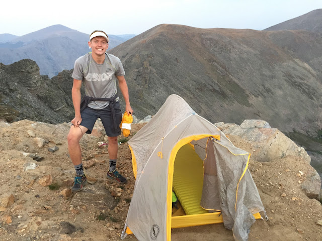
| Our campsite on the edge of the ridge |
We headed down to Boulder-Grand Pass and bypassed the first of many summits. Tanima sticks way out to the east and in our tired state we already concluded that we needed to conserve as much energy as we could to just make Buchanan Pass. We skipped it. But we did not skip the Cleaver. On my only go at the Pfiffner Direct I was in the lead and zipped by this tiny summit enroute to the north face of Isolation. I was the rope gun for Isolation and we were losing the light. I got to the base and was pulling my harness and flaking the rope when Homie comes up to me and says, "Did you get the summit of the Cleaver?" I asked, "What's the Cleaver?" Fifteen years later, as Derek and I scrambled to the top I realized that I passed within 60 seconds of scrambling from this summit. Those 60 seconds had taken me fifteen years to complete.
We got to Isolation's north face just before 3 p.m. Peter Bakwin told me about a sneak that involved descending 200 vertical feet on the west side, but we opted to tackle the 5.5 pitch out of the notch. I'd done it once before, with a rope. We went slow and solid and I felt the climbing here was the best we did on the traverse. The rock is really good and the climbing not very continuous. It was one of the most fun sections of the entire trip.
 |
| Working along endless tricky sections on the ridge from Algonquin to Paiute |
Once we got to the more gentle slopes higher up, we took our first and only extended break, though it only lasted about 15 minutes. I had hoped to get from here to Buchanan Pass in three hours. My buddy Mark, watching our Spot track, said the same to Sheri. But we both didn't factor in our massively weakened state due to dehydration. We did find a couple of pools of standing water by Ouzel Peak and we drank out of them and filled some containers. We trudged onwards.
 |
| One water source we used. |
Towards the end of the day, while making what we thought was a beeline to Buchanan Pass we came to a giant valley. We had to turn 90 degrees to our left and stay on the winding ridge. It looked so long. Derek said, “I think we should pull the cord.” We still had 30 or 40 minutes of light and we could have continued via headlamp, but new disappointment was too much in our tired, dehydrated state. We bivied. We pulled out our 2-man, 2-pound tent and found the only flat spot within miles, perched right on the edge of a steep slope. We secured the tent with rocks and our trekking poles, inflated our pads and crawled inside for some badly needed rest. We’d remain there for 11 hours, yet hardly feel rested the next morning. Derek estimated that we recovered about 15% of our strength.
 |
| Beautiful morning light on the traverse north of Buchanan Pass. |
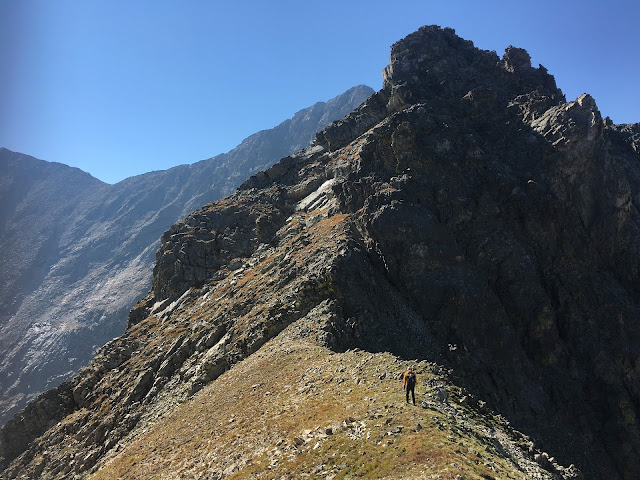
We didn’t get moving the next morning until past 6:30 a.m. It wasn’t that cold but it also wasn’t that light out. We dropped down the steep, rock-studded grassy slope into the saddle and then dropped further to get around some rock towers. And then up. And then down and then up and one final down to Buchanan Pass. We were going to bail here due to fatigue and dehydration but we found some more standing pools of water. We drank heartily and filled our containers. Our thirst sated, but still weak, we decided to continue over Paiute, mostly because Sheri was over that side in the next drainage. We sent her another text message to meet us at the Audubon Trailhead and started the arduous traverse, skipping the summit of Sawtooth, over to the top of Algonquin. From there the view is daunting to say the least. A very exposed, technical, extremely complicated, rocky ridge sculpted a tortured path over to the saddle below Paiute. I’d done this section once before and forgotten nearly everything about it. I led us astray a couple of times, wasting time, but more importantly wasting precious energy. It took forever, but we eventually arrived at the saddle.
This was the only part that I had remembered from my previous trip. We scrambled easily up to final headwall, which is quite daunting. My one time up here before, I found a 30-40-foot steep section that was probably 5.6 or 5.7 with some rests, but tricky, insecure climbing in-between. When I did this before I had a rope and belayed my partners up it and hauled up my pack. This time we had no such aids. I went first and made the top, though a bit concerned with the difficulty of the climbing, which is much harder than the climbing on Isolation and more insecure. Derek had some trouble. Enough to get me concerned I climbed a bit higher to more secure ground, took off my pack and dug out the three slings I’d carried to secure the tent. I looped them over a secure rock and dropped them down. It would only help, if at all, on the final crux. Derek’s poles were sticking high out of his pack, as they couldn’t be collapsed much and in the way. I was so stressed and nervous watching him work it out. I could do nothing to help him. He didn’t rush and he took his time to work out the moves that felt solid to him and he got up it.
 |
| Highly complex and technical ground enroute to Paiute in the background. |
Relieved, we continued up 3rd and 4th class terrain to the summit. Our last for this attempt. We relaxed for a bit, ate, and drank. We saw Sheri's text telling us that she'd meet us at the trailhead. We descended to a saddle and then descended loose, skiable terrain down into the cirque. We emptied our shoes and trudged to the trailhead. We found Sheri waiting with the most impressive spread of food and drink that I've ever seen at a trailhead. And she had carried the entire thing into Pawnee Pass for us! My buddy Mark had made us fresh bread and delivered to our house at 5:25 a.m. I was overwhelmed by the love and support, but disappointed that we'd let them down. Our support was first class. We were not. At least on this attempt.
 |
| Feeling bad about bailing on the LA Freeway, I moved this boulder onto these rocks as a final workout. |
Despite our failure, Derek was very excited about the attempt. He'd never done anything like it before and now he knows a lot about the LA Freeway. He had an incredible adventure and found his limits. I had a tremendous weekend bonding with my son.
 |
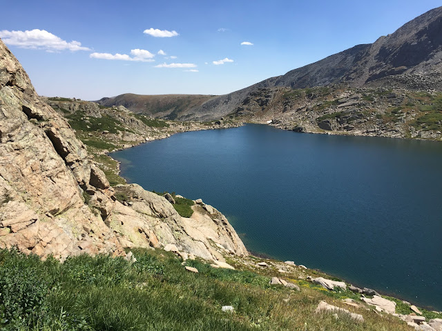
| Blue Lake. We are nearly down to the first real trail since leaving the Keyhole Route on Longs Peak |
The peaks you are supposed to climb on this traverse with the ones in bold being the summits we actually hit:
Longs Peak
Pagoda Peak
Chiefs Head Peak
Mt. Alice
Tanima Peak
The Cleaver
Isolation Peak
Ouzel Peak
Ogalalla Peak
Peak 12277
Red Deer Peak
Sawtooth Peak
Algonquin Peak
Paiute Peak
Mt. Toll
Pawnee Peak
Shoshoni Peak
Apache Peak
Navajo Peak
Arikaree Peak
North Arapaho Peak
South Arapaho Peak
Wow. That looks pretty lame. Lots of room for improvement, I guess. Good thing we didn't make it as that would be a pretty significant asterisk. Derek was up for doing it "right" and I somehow convinced myself that we didn't need the summits. If we'd done them all, we might have bailed at Buchanan Pass. A great father-son adventure and learning experience.
What we learned and what we'd do differently:
When I finished this adventure I could hardly imagine even hiking again and was absolutely sure I'd never try this again. Yet, just a day afterwards, Derek and I were brainstorming how we'd do it differently. First, intimately knowledge of the route is key as tons of time and effort can be wasted finding the correct passages. This effort doesn't just drain you physically, but does as much damage to you mentally.
Next, we should have started much earlier and did almost all of Longs Peak in the dark. This would have saved us hours of daylight that we needed to make Buchanan Pass.
Third, we envisioned the ideal support plan. While the LA Freeway has been done unsupported (currently only by Buzz), it can be made considerably more doable with support. Dropping below the Divide to get water adds time and effort to an already epic undertaking. We'd start with 120 ounces of water each and plan to drink it all by Boulder Grand Pass. At the same time that we'd start from the Longs Peak Trailhead, Sheri would start from Wild Basin and hike into Boulder Grand Pass (9 miles one way) and leave 200 ounces of water. She'd then hike back out and then, with 4WD support, hike into Buchanan Pass with two gallons of extra water where she'd meet Derek and I for the night. Maybe she'd even carry in our sleeping bags, pads, and tent. The next day, she'd hike out, certainly with our overnight gear, and then hike into Pawnee Pass with more water and food for us. Finally, she'd meet us on South Arapahoe Peak with final snacks and drinks. This would be a grueling weekend for Sheri as well, but I think she'd be into it.


